Contact us Get started

Nature data, ready for analysis

Cecil makes nature datasets consistent, accessible, and ready for analysis.

Get started
Nature datasets

Nature datasets

Browse scientifically curated datasets for your area of interest. Refine your search by spatial and temporal attributes across commercial and open datasets.

Datasets
Interoperability

Interoperability

Streamline the process to acquire and analyse datasets from industry-leading data providers with one contract, one integration, and no minimum usage requirements.

SDK documentation
Built to scale

Built to scale

Develop secure, reliable, and scalable workflows with the Cecil SDK. Leverage innovative spatial technologies to efficiently analyse multi-dimensional datasets.

Code examples
import cecil
import matplotlib.pyplot as plt

client = cecil.Client()

ds = client.load_xarray('f644efb3-8ba4-4bc4-8333-1ace54a3f111')

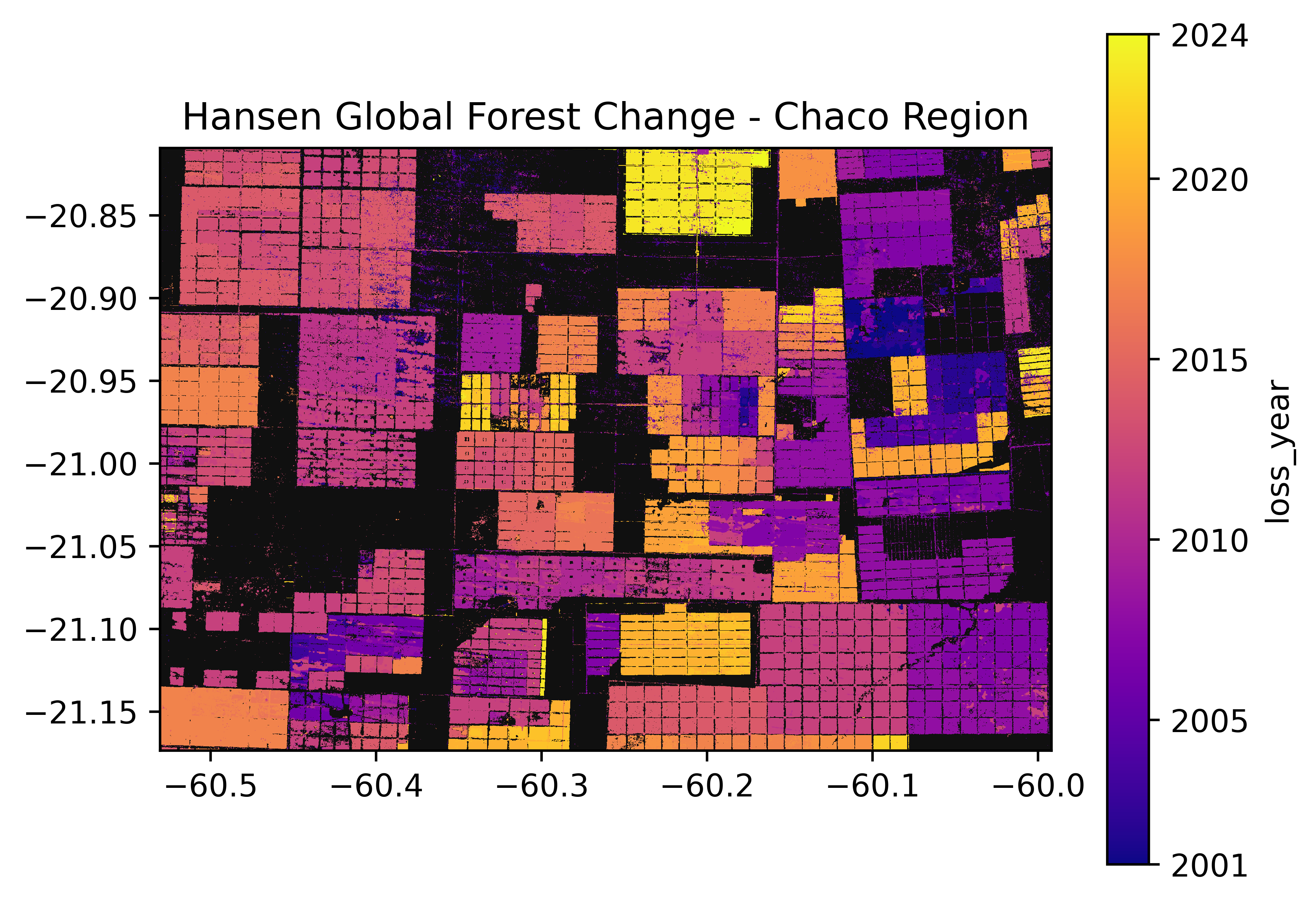
# Pixel values above 0 indicate forest loss years.
forest_loss = ds['loss_year'].where(ds['loss_year'] > 0)

# Convert values from 1-24 to 2001-2024.
forest_loss_years = forest_loss + 2000

forest_loss_years.plot(cmap='plasma').colorbar.set_ticks(
    [2001, 2005, 2010, 2015, 2020, 2024]
)

plt.gca().set_title('Hansen Global Forest Change - Chaco Region')
plt.gca().set_aspect('equal')
plt.gca().set_facecolor('#101010')

plt.show()

Get started in a few steps

Supercharge your productivity to acquire and analyse nature datasets.

Get started

A scientific approach to nature

Cecil draws on foundational scientific principles to identify and describe nature in an objective, transparent, and rigorous way.

We have developed a repeatable and scalable operating model with the research community to curate nature datasets and deliver the academic gold standard for nature data.

We collaborate with a network of industry experts to consolidate dataset protocols, methods, and specifications into clear and comprehensive documentation.

Unlocking efficient analysis

We leverage industry-leading spatial technologies such as Xarray, Zarr, and GeoParquet that enable efficient analysis at scale. Whether you’re working with time-series, performing complex spatial operations, or joining multiple datasets, we combine geospatial and cloud infrastructure expertise in processing billions of hectares for global organisations.

Cecil provides a seamless integration with your existing tools and workflows. This compatibility allows you to use your preferred geospatial libraries, connect with visualisation platforms, and incorporate datasets into general-purpose data pipelines, maximising the value of your nature data.

Transparent roadmap

We provide a single and consistent point of integration with a variety of nature datasets from industry-leading data providers and we are constantly developing new dataset integrations.

Contact us to learn more about our product roadmap. We look forward to hearing which datasets and feature improvements are high priority for your organisation.

Contact us